We have made very slow progress since my last blog due to the high winds on Lake Michigan. It has caused us to stay for two and three days in Marinas because it was too rough to leave.
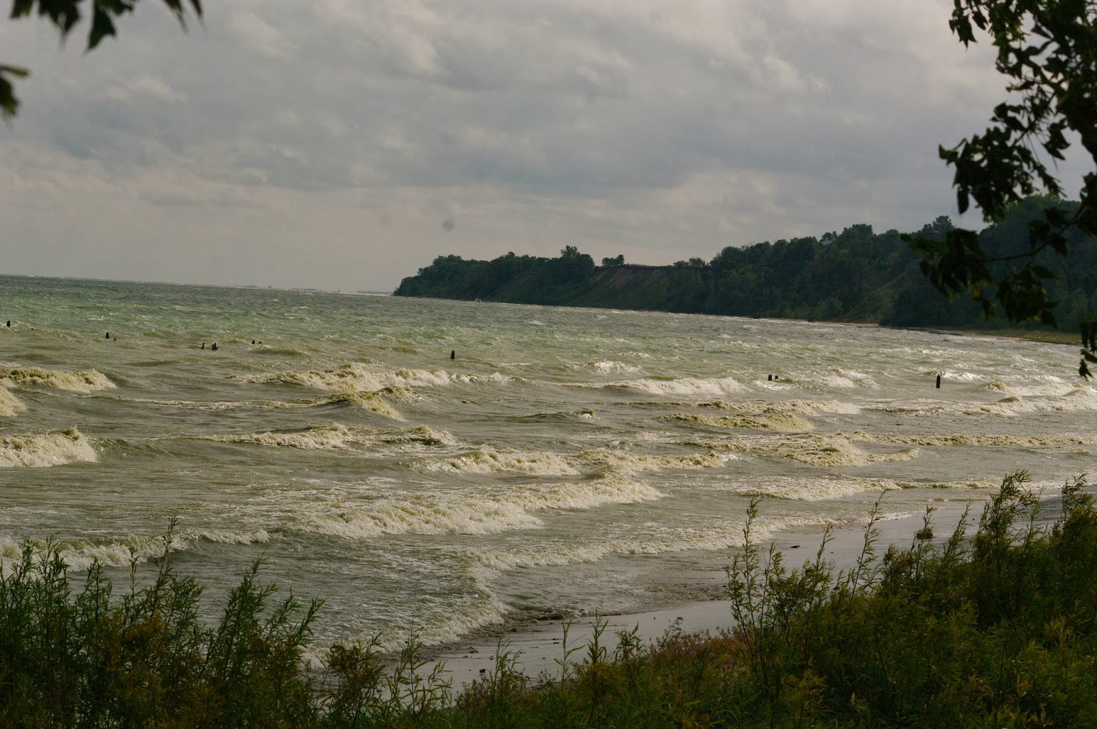
We did try to leave Kewaunee, Wisconsin 3 days ago but had to turn around and head back to the marina because the waves were too much for the "Rover" (and me).
I took a walk around Kewaunee (pop 2900) and found a closed up for the season town. I did come across the tug "Ludington" that took part in the Normandy D-Day Evacuation towing ammunition barges across the English Channel. The tug was originally called "Major Wilbur F. Browder" and had 2 50 caliber machine guns on the front. The name was changed to "Ludington" in 1947.
Even though it was extremely windy I took a walk out to the lighthouse at the entrance to the harbour. Men were fishing for salmon on the breakwater and you could see the salmon leaping into the air but not onto the end of their fishing rods.
Many of the boats in the Marina were decked out for fishing and some of them were over decked. I do not know how the men or women avoided getting their lines tangled.
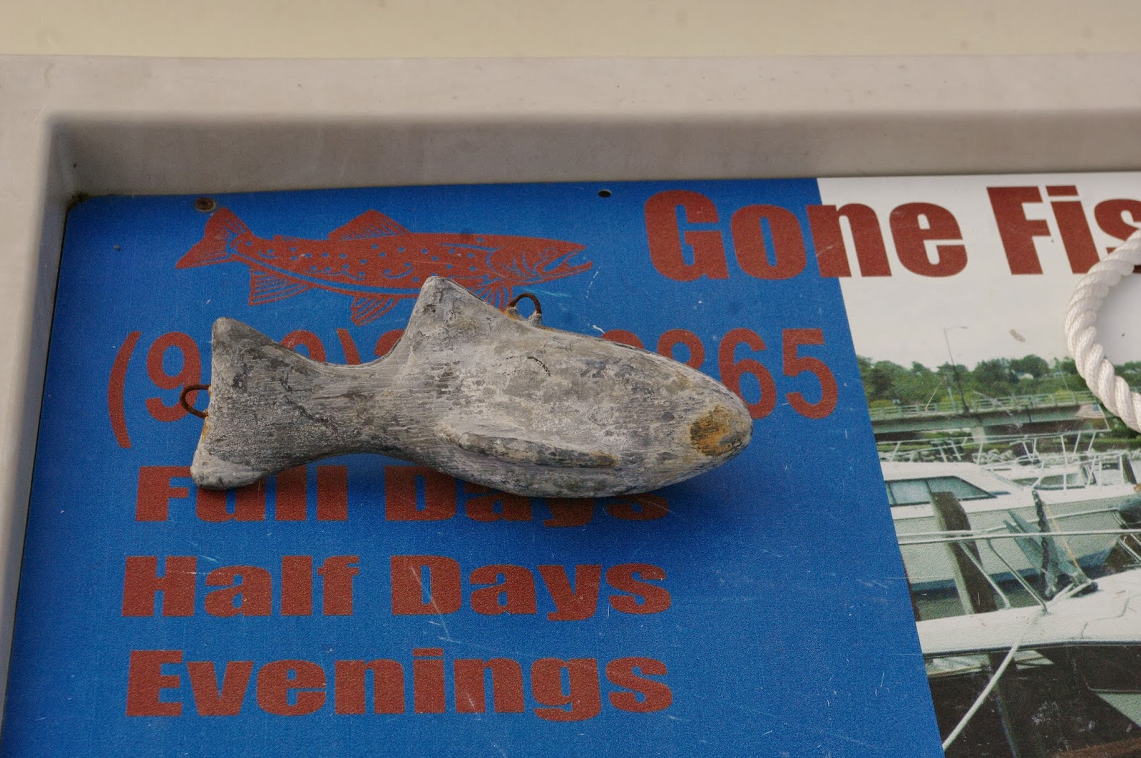
The above boat had a storage box on the deck behind him and on it was a weight that must have weighed at least 10lbs and looked like a fish. I asked Mike, the Marina Assistant Manager was it was for as there was no way it could go on the end of a regular fishing rod. He said it was for an outrigger that pulls the lines out to the side of the boat. The "fish" obviously goes on the bottom of the lake with several lines attached.
Mike was very kind to us. He drove me to a grocery store to get supplies because it was too far to bicycle. He hopes to retire in South America when the time comes and we wish him and his wife well.
Sunset was not all that spectacular at the Kewaunee Marina as I had hoped to capture salmon leaping. It was not to be so I took a sunset shot of the bridge not too far from our slip.
Last night we were expecting very strong storms but they did not materialise, thank-goodness although I do like to watch a good thunderstorm.
Gary decided to leave the marina this morning as we are getting quite behind with our schedule. It was foggy when we left and rough all the way to Sheboygan making the journey very unpleasant. The weather forecast for the next few days is not good either.
Well, as mentioned earlier we are in Sheboygan for the night, maybe longer if the weather does not cooperate.
I have been asked how much is it to stay at a marina. The price varies and is related to the length of your boat and what amenities the marina has to offer (showers, toilets, laundry etc). We have paid anywhere from $1.25/foot to $2.25/foot. The price can go a lot higher in peak season and for very fancy resorts.
Just to prove I can get up early if I want to, I got up for sunrise this am. In fact, I was up an hour and half before sunrise (5am). Unfortunately, sunrise was not worth it but I will show you the best of what I took.
This is a view of the marina where we stayed. It actually had a swimming pool and a hot tub (both outside) which we did not use because the weather was quite windy and cool.
I could not resist taking this photo. The marina has installed sound machines and kites to keep the gulls away. It did not work as our pier was covered in bird droppings.
We have come across some strange looking boats on our journey. Here are just three of them.
This little guy was called "Squirt" and he was the local fire boat.
The above boat was the tiniest powered catamaran I have ever seen - no more than 6 feet with a huge engine on the back. Gary said it was good for calm, smooth water only. I guess it had not been on the lake for a while!!!!
This pedalled catamaran/canoe I think would have been a lot of fun on rivers and creeks.
Gary continues to hang onto his stone. I have been telling him for years that he never likes to part with anything!!!
TIDBITS:
We have travelled 1768 nautical miles so far. The furthest east we got was at Saurel on the St Lawrence (W73.1153, N46.0495). The furthest north we got was Blind River (N46.1781, W82.965).
Kingston Rover Loop Map


Hi there, Margaret
ReplyDelete